
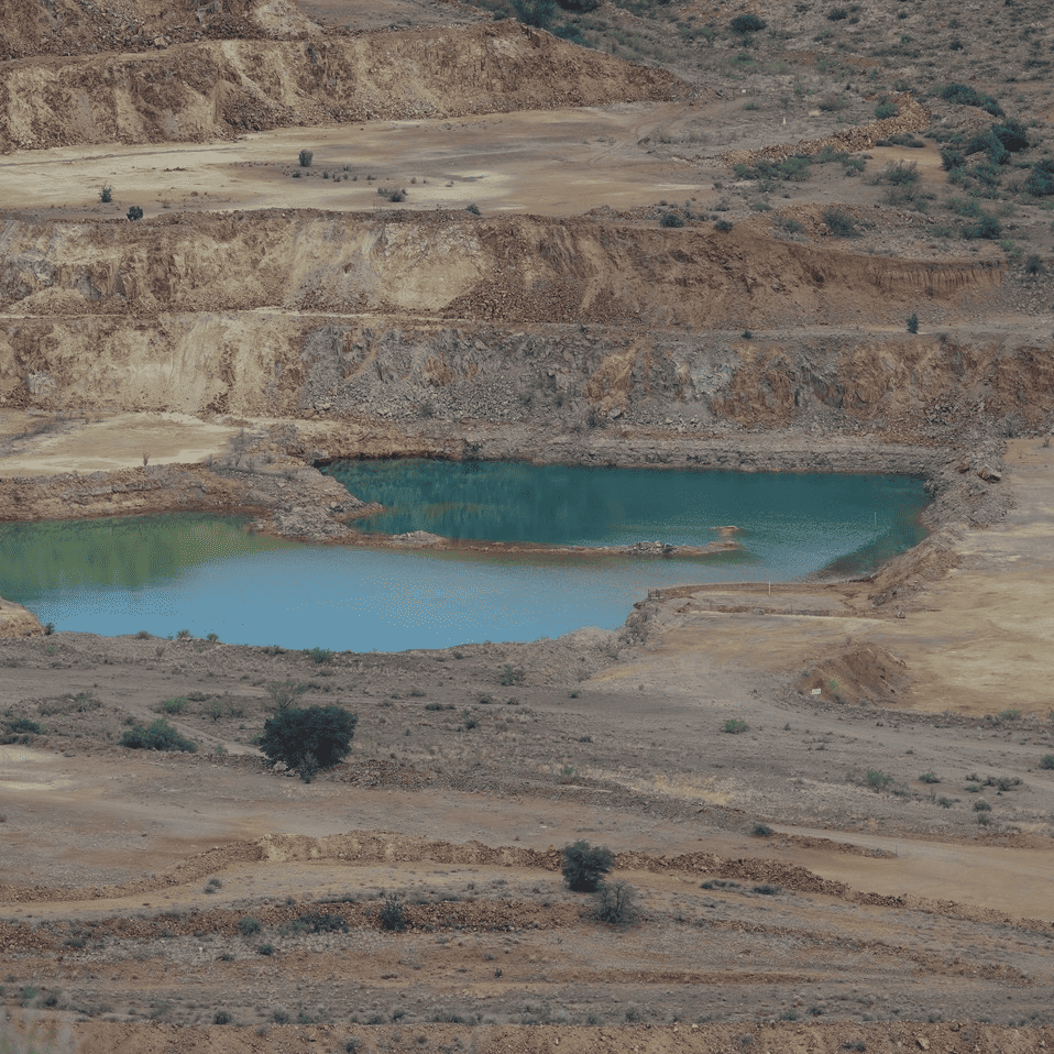

NMCC’s amended application to mine Copper Flat Mine focuses on the change in tailings management and the claim of saving water. It neglects to discuss how the loss of 80% of their claimed water rights would affect their plan to reclaim the pit.
At end of mining, the hole in the ground that has been mined, the pit, will be 1,000 feet deep and 2,800 feet wide. Over time, the minerals of the pit walls being exposed to oxygen and rain will produce acid run-off. In order to prevent this, the original plan was to fill the pit with water pumped (24/7) from their four production wells (near Alto Road, the back way into Animas Creek). The water will prevent oxygen contact. The filling would be up to the level of water balance between the created pitlake and groundwater levels in order to produce a “hydrologic sink,” that is, a balance between inflow and outflow so that the mine can claim that groundwater moves into the pitlake and is evaporated to maintain balance and therefore water will not flow out polluting groundwater.
When the plan was conceived, the mine had 5 times more water rights than now. The filling of the pit was to take 6 months, and the plan was called “rapid fill.” With the reduced water rights, it will take NMCC 2 ½ to 3 years. Not very rapid. Yet, NMCC is sticking to their plan, a very slow rapid fill.
I have never like this reclamation plan for three reasons. 1) the use of scarce groundwater to create a possibly polluted lake that endangers beast and fowl does not seem to me beneficial to the public welfare; 2) the use of scarce groundwater instead of waste rock to partially fill the pit bottom makes no sense to me when storing waste rocks in piles is itself a problem, since every cubic yard of rock the mine dumps into the pit reduces water depleted from the aquifer by a cubic yard; and 3) the hydrologic sink is a generalization (though approved by the courts) because in reality the level of the pitlake is fluctuating all the time, both above and below the balance level, because of evaporation and precipitation; so that, polluted water will, in fact, enter the aquifer and mix with groundwater.
Possibly, the pit could be lined with HDPE membrane, all the waste rock mining has generated could be put into the pit and then water added to created a kind of marshland which will sustain the kind of vegetation that neutralizes the pollution in the lake. There are downsides to this suggestion, but as non-experts we don’t know what the alternatives are.
The fact that rapid fill is to take 2 ½ years before the pit walls are safely covered gives another reason to dislike this plan. How much acid will be formed on the unsubmerged pit walls during those 2 ½ years to be later washed into the pitlake?
This seems to me an opportunity for the NMED (Environment Department) and the MMD to revisit their acceptance of the rapid fill reclamation of the pit. I think we should ask for this at the MMD hearing. I will have more to say about the pit in later postings; in particular, I’d like to look closely at the geochemical study which concludes that the future pit lake will not exceed pollution standards because the future pitlake will be chemically like the old pitlake. Yet, the study also provides evidence that over the past 40 years the old pitlake developed serious acidity problems.
One last item before I close. We don’t know, and NMCC does not say, what impact the mine’s groundwater pumping will have on the aquifer hydrologically. The mine’s modeling of the aquifer has been shown to be outdated and faulty and declared so by the State Engineer. The Office of the State Engineer has modeled the pumping of 1,400 AFY from the mine’s production wells four miles from Caballo Reservoir and found that it depletes flows in Animas Creek, depletes wells along Animas Creek, and depletes the Rio Grande River system at Caballo Reservoir. However, the amended application limits the use of these production wells to some 800 AFY. The rest of their 1,100 afy water rights will be pumped from three wells at the mine site, further west but from the same aquifer.
The combined effects of this pumping along with the depletion of the aquifer through mining the pit, dewatering the pit and withdrawing groundwater in the ore, affects the regional hydrology. But neither we nor the mine knows how because the actual use has not been modeled. It seems fairly certain that Hillsboro Pitchfork Ranch will lose at least one well, that there will be impacts on other Pitchfork wells and on Ladder Ranch wells and springs, and perhaps on Lower Animas Ditch waters and on flowing (artesian) wells near the reservoir. Without computer modeling, it would be difficult to say if Caballo Reservoir will be impacted. If the river is impacted, how will we know? If their water use contributes to a violation of the Rio Grande Compact, the cost to New Mexico taxpayers may be very significant.
The updated hydrological report in the application recognizes this negative impact on the regional aquifer generally, but it declines to do a hydrological study because it declares that such harm is within the mine’s rights. The report even claims that it is within the mine’s right to deplete the Rio Grande River. This claim that the mine’s right to use water trumps all other water users’ rights seems far-fetched to me. I will consider this claim in a later post.